
Article Categories
- All Categories
-
 Data Structure
-
 Networking
-
 RDBMS
RDBMS
-
 Operating System
-
 Java
Java
-
 MS Excel
-
 iOS
iOS
-
 HTML
HTML
-
 CSS
CSS
-
 Android
-
 Python
-
 C Programming
-
 C++
C++
-
 C#
C#
-
 MongoDB
-
 MySQL
MySQL
-
 Javascript
-
 PHP
PHP
-
 Economics & Finance
What is the full form of GEO?
Introduction
Geostationary Earth Orbit (GEO) is a particular kind of orbit that revolves around the Earth. A satellite in a GEO circles the planet at a height of around 36,000 kilometres (22,236 miles) above the equator, and one orbit takes the satellite precisely 24 hours to complete, which is the same as the Earth's rotation period.
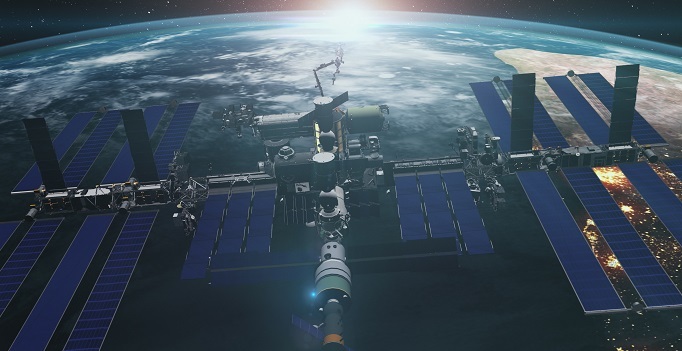
This makes it the perfect place for communication, weather monitoring, and navigation satellites since it makes the satellite seem to be stationary to someone on the ground. In the disciplines of satellite technology, space exploration, and telecommunications, the word GEO is frequently used.
Characteristics of GEO
The following are a geostationary earth orbit's (GEO) main characteristic
Altitude A satellite in GEO orbit is located around 36,000 kilometers (22,236 miles) above the equator
Orbital Period The orbital period of GEO satellites, which is equal to the period of the Earth's rotation, is exactly 24 hours.
Angular Velocity A satellite in GEO moves with the same angular velocity as the planet. In other words, from the perspective of a person standing on the surface of the Earth, the satellite seems to be stationary.
Coverage Area An average of up to one-third of the Earth's surface may be covered by GEO satellites, a significant portion.
Communication Wide areas can have continual access for telephone, television, and internet services thanks to communication satellites in GEO.
Weather Monitoring Real-time data on weather patterns and events, such as hurricanes, typhoons, and cyclones, may be obtained from weather satellites in GEO.
Uses of GEO
There are several uses for Geostationary Earth Orbit (GEO) satellites, including
Communication Television, phone, and internet services are always connected thanks to communication satellites in geostationary orbit (GEO). These satellites are often used to transmit television broadcasts, offer satellite internet and phone services, and facilitate cross-border data transmission.
Weather Monitoring Real-time monitoring of the Earth's weather patterns by weather satellites in GEO is essential for weather forecasting and catastrophe response. These satellites have a variety of sensors that can track and identify meteorological phenomena including cloud cover, temperature, humidity, wind speed, and others.
Navigation Global users can receive precise position and time data from GEO navigation satellites like GPS. Users may navigate and track their position with great precision because of these satellites' employment of a signalling system to compute the precise location of GPS receivers on the ground.

Earth Observation Earth observation tasks including tracking climate change, seeing natural disasters, and performing environmental research can be accomplished by satellites in GEO. High-resolution photographs of the Earth's surface may be obtained from these satellites, enabling scientists and researchers to thoroughly examine the globe.
Military and Defense Military and defence uses for GEO satellites include communication, navigation, and intelligence collection. These satellites provide real-time monitoring and tracking of military assets as well as secure and dependable communication channels for military operations.
Commercial and Scientific Applications Remote sensing, telemedicine, and space research are just a few of the many scientific and commercial uses for GEO satellites. These satellites offer a platform for study and experimentation in microgravity as well as space-based testing of novel materials and technology.
Advantages and disadvantages of GEO
Advantages of GEO
Continuous Coverage A considerable percentage of the Earth's surface is continuously covered by satellites in GEO, making them perfect for uses including communication, weather monitoring, and navigation.
Stationary Position GEO satellites are simple to follow and communicate with since they look stationary to an observer on Earth's surface.
Large Coverage Area Up to one-third of the planet's surface may often be covered by satellites in GEO
Long Life Compared to satellites in other orbits, GEO satellites have a longer operating life, which lessens the need for frequent replacement.
Disadvantages of GEO:
High Altitude As a result of their great altitude (about 36,000 kilometers above the surface of the Earth), GEO satellites may have longer signal delays and weaker signals, which may impair communication and data transfer.
Limited Capacity GEO satellites can only broadcast a certain quantity of data, which can lead to congestion and worse customer quality of service.
Vulnerability GEO satellites are susceptible to solar storms and space debris, which can harm or incapacitate them.
High Cost Due to the high cost of creating and deploying satellites into GEO, these services may only be accessible to those who can pay them.
Limited Flexibility A satellite's flexibility and capacity to adapt to changing demands is constrained after it is installed in GEO since it cannot be readily transferred to another location.
While GEO provides numerous benefits, such as constant coverage and a fixed location, it also has a number of disadvantages, such as high altitude, limited capacity, fragility, high cost, and restricted flexibility. When choosing the best orbit for a given application, several criteria must be taken into account.
Conclusion
A satellite in GEO is located around 36,000 kilometers (22,236 miles) above the surface of the planet. The satellite may complete an orbit at this height in exactly 24 hours, which is the same as the duration required for the Earth to rotate. As a result, from the viewpoint of a viewer on the ground, the satellite seems to be stationary. Among the many uses of satellites in GEO are communication, weather monitoring, and navigation. Television, phone, and internet services are always connected thanks to communication satellites in geostationary orbit (GEO).
FAQs
Q1. What is GEO, and how does it differ from other Earth orbits?
A satellite in a GEO Earth orbit circles the planet at a height of around 36,000 kilometers above the equator. A satellite in GEO seems to be stationary to someone on the ground, unlike in other Earth orbits.
Q2. What are some of the applications of GEO satellites?
Communication, weather monitoring, navigation, Earth observation, military and defence, and scientific research are just a few of the uses for GEO satellites.
Q3. What communication services are offered by GEO satellites?
Signals are transmitted to and from ground-based stations by GEO satellites, which offer communication services. Communication over a large range is made possible by the satellite, which receives signals from one station and delivers them to another.

821 Views
